Brace yourself! Extreme storms are sweeping the nation—are YOU in the danger zone?
- Replies 0
The changing seasons bring unpredictable weather, but this year’s transition has been especially fierce.
From powerful blizzards in the Midwest to raging dust storms in the South, the latest weather patterns are proving both relentless and dangerous.
As severe storms continue to develop, meteorologists warn that more regions could be at risk in the coming days.
A storm is strengthening over the Midwest, with forecasters predicting blizzard conditions across multiple states.
The nation is being hit hard by the system, which is happening only days after a devastating storm that killed over 40 people swept through.

According to forecaster Paul Ziegenfelder, who made the announcement in a public discussion on the Weather Prediction Center website on Wednesday, the most recent storm—a deep region of low pressure—will bring significant snow to the Central Plains before rerouting into Thursday through the Upper Midwest and Upper Great Lakes.
"Snowfall rates up to 2 inches per hour will likely combine with wind gusts over 50 mph to produce blizzard conditions," Ziegenfelder warned.
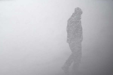
The most dangerous impacts are projected for northern Kansas through southern Minnesota, where near-zero visibility could make travel nearly impossible.
Also read: Cold weather myths exposed—what’s actually making you sick
Ziegenfelder has cautioned that those in affected areas should prepare for major disruptions.
Under such extreme conditions, even routine trips may become perilous due to occasional near-zero visibility, heightening the likelihood of accidents and necessitating emergency rescues.
The National Weather Service indicated that although the blizzard threat will diminish overnight, moderate to heavy snowfall and strong winds will continue to affect regions in Wisconsin and the Upper Peninsula of Michigan.
The weather service predicted further snowfall over 6 inches in regions of eastern Nebraska, northern Iowa, and southern Minnesota.
The weather service indicated that scattered, severe thunderstorms were also expected during the night across Indiana, portions of Kentucky, and Tennessee.
Meanwhile, strong wind gusts over 50 mph will persist across the southern Plains into the evening, as reported by the weather service.
The government cautioned homeowners about airborne dust, fallen trees, and broken power lines that may result in power outages.
As of Wednesday night, over 262,000 residences and enterprises were experiencing power outages in the US, according to USA TODAY's power outage tracker.
Meanwhile, in Texas, a massive dust storm recently swept through El Paso, turning the skies a dense, sandy brown.
The storm significantly reduced visibility, leading officials to issue travel warnings for residents in affected areas.
Wind gusts reached a staggering 101 mph in some regions, showcasing the sheer power of the storm.
While the winds have since calmed, forecasters warn that dry conditions and continued gusts have created critical fire weather risks across the Southern High Plains.
The combination of high winds, low humidity, and dry vegetation means even a small spark could quickly escalate into a fast-moving wildfire.
Also read: Catastrophic tornadoes strike—are you prepared for the next one?
The National Weather Service Storm Prediction Center has also issued an enhanced risk warning for severe thunderstorms across multiple states.
The affected regions include parts of the Mississippi and Ohio Valleys, as well as the Upper Great Lakes.
Forecasters predict that these storms could bring destructive hail, damaging winds, and multiple tornadoes.
There is even concern that some tornadoes could be classified as EF5, the most powerful category, with winds surpassing 200 mph.
 Have you experienced any of these wild weather phenomena? Do you have any tips for preparing for severe weather conditions? Or perhaps you have questions about how to stay safe during a specific type of storm?
Share your stories, advice, and inquiries in the comments below. Let's support each other through these turbulent times and emerge stronger and more connected as a community.
Read next: Is Your Go-Bag Ready? The Ultimate Lifesaving Checklist You Need Now!
From powerful blizzards in the Midwest to raging dust storms in the South, the latest weather patterns are proving both relentless and dangerous.
As severe storms continue to develop, meteorologists warn that more regions could be at risk in the coming days.
A storm is strengthening over the Midwest, with forecasters predicting blizzard conditions across multiple states.
The nation is being hit hard by the system, which is happening only days after a devastating storm that killed over 40 people swept through.

A strong spring storm in the Midwest is likely to cause blizzard conditions. Image source: Zac Durant / Unsplash
According to forecaster Paul Ziegenfelder, who made the announcement in a public discussion on the Weather Prediction Center website on Wednesday, the most recent storm—a deep region of low pressure—will bring significant snow to the Central Plains before rerouting into Thursday through the Upper Midwest and Upper Great Lakes.
"Snowfall rates up to 2 inches per hour will likely combine with wind gusts over 50 mph to produce blizzard conditions," Ziegenfelder warned.
The most dangerous impacts are projected for northern Kansas through southern Minnesota, where near-zero visibility could make travel nearly impossible.
Also read: Cold weather myths exposed—what’s actually making you sick
Ziegenfelder has cautioned that those in affected areas should prepare for major disruptions.
Under such extreme conditions, even routine trips may become perilous due to occasional near-zero visibility, heightening the likelihood of accidents and necessitating emergency rescues.
The National Weather Service indicated that although the blizzard threat will diminish overnight, moderate to heavy snowfall and strong winds will continue to affect regions in Wisconsin and the Upper Peninsula of Michigan.
The weather service predicted further snowfall over 6 inches in regions of eastern Nebraska, northern Iowa, and southern Minnesota.
The weather service indicated that scattered, severe thunderstorms were also expected during the night across Indiana, portions of Kentucky, and Tennessee.
Meanwhile, strong wind gusts over 50 mph will persist across the southern Plains into the evening, as reported by the weather service.
The government cautioned homeowners about airborne dust, fallen trees, and broken power lines that may result in power outages.
As of Wednesday night, over 262,000 residences and enterprises were experiencing power outages in the US, according to USA TODAY's power outage tracker.
Meanwhile, in Texas, a massive dust storm recently swept through El Paso, turning the skies a dense, sandy brown.
The storm significantly reduced visibility, leading officials to issue travel warnings for residents in affected areas.
Wind gusts reached a staggering 101 mph in some regions, showcasing the sheer power of the storm.
While the winds have since calmed, forecasters warn that dry conditions and continued gusts have created critical fire weather risks across the Southern High Plains.
The combination of high winds, low humidity, and dry vegetation means even a small spark could quickly escalate into a fast-moving wildfire.
Also read: Catastrophic tornadoes strike—are you prepared for the next one?
The National Weather Service Storm Prediction Center has also issued an enhanced risk warning for severe thunderstorms across multiple states.
The affected regions include parts of the Mississippi and Ohio Valleys, as well as the Upper Great Lakes.
Forecasters predict that these storms could bring destructive hail, damaging winds, and multiple tornadoes.
There is even concern that some tornadoes could be classified as EF5, the most powerful category, with winds surpassing 200 mph.
Key Takeaways
- A strong spring storm in the Midwest is likely to cause blizzard conditions with heavy snow and strong winds leading to near-zero visibility.
- The system is expected to bring severe weather, including the potential for wildfires due to dry conditions and dust storms, particularly affecting Texas.
- The National Weather Service has warned of a critical risk of fire weather on the Southern High Plains, as well as an enhanced risk of severe thunderstorms over other regions.
- Severe thunderstorms may result in hail and multiple tornadoes, with forecasters not ruling out the possibility of EF5 tornadoes, the most powerful on the Enhanced Fujita Scale.
Share your stories, advice, and inquiries in the comments below. Let's support each other through these turbulent times and emerge stronger and more connected as a community.
Read next: Is Your Go-Bag Ready? The Ultimate Lifesaving Checklist You Need Now!


